What is Drone & UAV Mapping?
High-Resolution Aerial Mapping for Any Site in the GTA
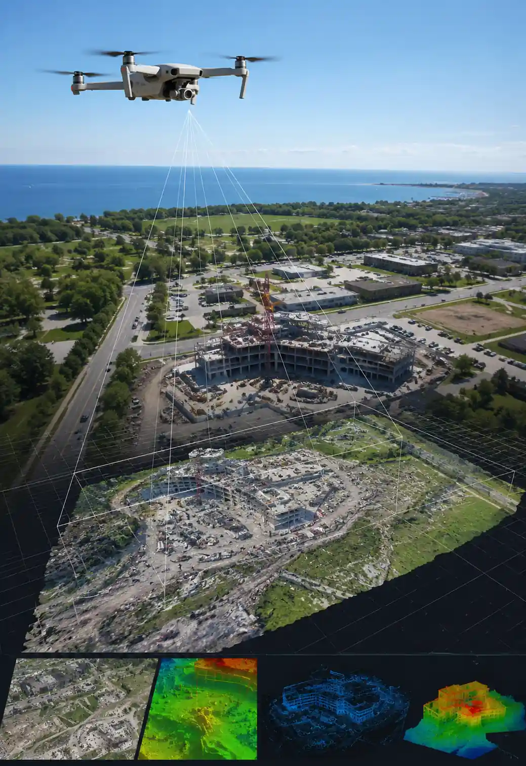
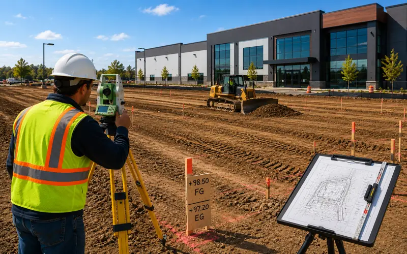
Drone and UAV mapping uses professional unmanned aerial vehicles equipped with high-resolution cameras and GPS systems to capture precise aerial imagery, topographic data, and 3D models of any site from above. Our Transport Canada certified drone pilots and licensed OLS professionals on our team combine aerial data capture with certified survey control — delivering results that are both visually stunning and legally accurate.
From large construction sites and subdivisions to quarries, agricultural land, and infrastructure corridors across Toronto, Mississauga, Brampton, Markham, and all GTA municipalities — our drone mapping services deliver aerial data that traditional survey methods simply cannot match in coverage, speed, and visual clarity.
2cm ground resolution aerial imagery
Ultra-high resolution imagery capturing detail impossible with satellite or traditional methods.
Transport Canada certified pilots + licensed OLS
Full regulatory compliance — certified drone pilots and licensed Ontario Land Surveyors on our team.
Orthomosaic, DSM & 3D model deliverables
Complete photogrammetry deliverables ready for your engineering, planning, or design team.
Service Areas
Drone & UAV Mapping Across All GTA Municipalities
Our Transport Canada certified pilots and licensed OLS team mobilize to any site across the Greater Toronto Area — delivering precise aerial mapping for projects of any size.
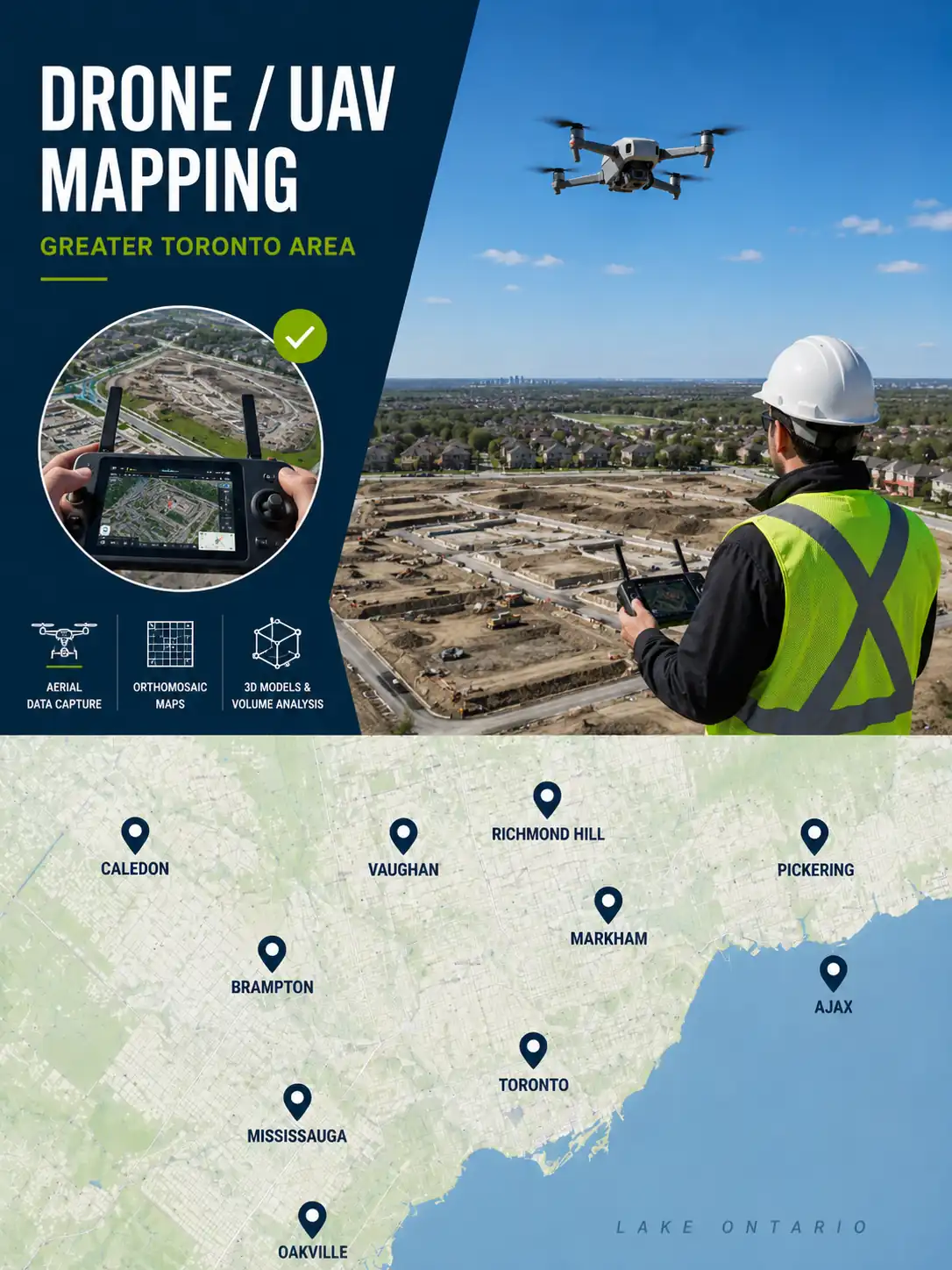
Serving all GTA municipalities
Related Services
Other Survey Services You May Need
Full-service surveying across the GTA
We offer a full range of professional land surveying services across the GTA. Explore other services commonly needed alongside as-built surveys.
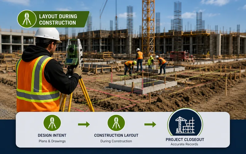 Construction Layout
During Build ✅
Construction Layout
During Build ✅
Construction Layout & Site Control
Precise construction layout during the build ensures all structures are positioned correctly from the start — making your as-built survey straightforward and your occupancy permit approval smooth.
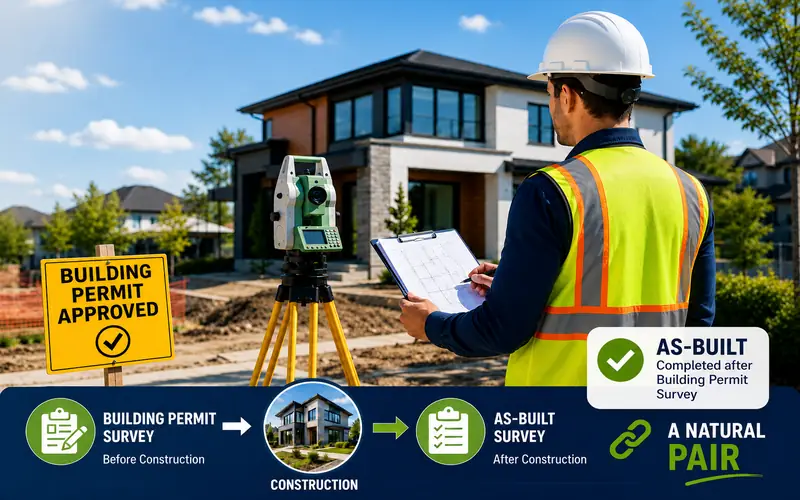 Permit Survey
Before Build ✅
Permit Survey
Before Build ✅
Survey for Building Permit
A building permit survey confirms your proposed structure location complies with all zoning and setback requirements before construction begins — the first step before an as-built survey is needed.
 Grading Survey
Often Combined ✅
Grading Survey
Often Combined ✅
Grading & Site Plan Support
As-built grading surveys confirm that final drainage grades match the approved grading plan — a common requirement for occupancy permit approval across all GTA municipalities.
We offer 10 professional survey services across all GTA municipalities — one trusted licensed OLS team for every project.