Precise elevation and contour surveys conducted by licensed OLS professionals on our team. Accepted by all GTA municipalities for building permits, grading plans, and site development projects.
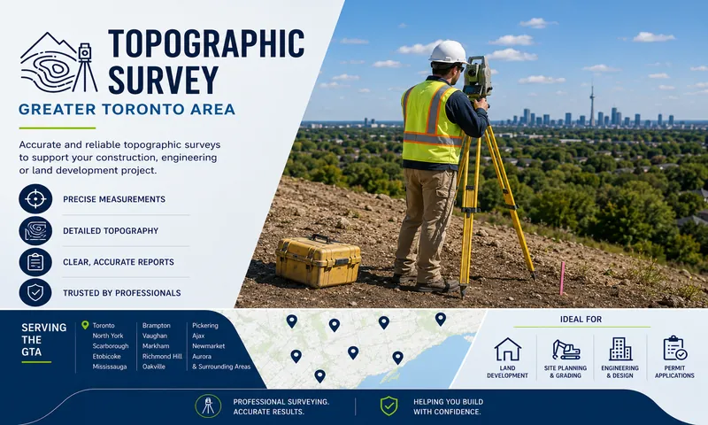
What is a Topographic Survey?
Overview
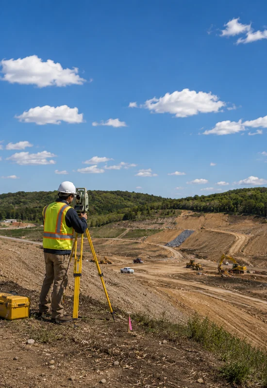
A topographic survey is a detailed measurement of the natural and man-made features of a property — including ground elevations, contour lines, slopes, drainage patterns, trees, structures, and utilities. It gives architects, engineers, and developers the precise data they need to design and build with confidence.
Whether you are submitting a grading plan, designing a new home, or applying for a building permit across Toronto, Mississauga, Brampton, Markham, or anywhere in the GTA — our licensed OLS professionals deliver precise, municipality-accepted topographic surveys on time and on budget.
Precise elevation & contour data
Detailed contour lines and spot elevations for accurate grading and drainage design.
Signed and sealed by licensed OLS professionals
Every topographic survey is certified by licensed Ontario Land Surveyors on our team.
Accepted by all GTA municipalities
Our surveys meet all requirements for building permits and site plan approvals across the GTA.
Who Needs This
Topographic surveys are required for a wide range of construction, development, and planning projects across the GTA. Here are the most common situations where you will need one.
Building Permit Applications
Many GTA municipalities require a topographic survey alongside your building permit application to document existing grades, drainage patterns, and elevation on your property before approving construction.
Grading & Drainage Plans
Engineers and architects rely on topographic surveys to design accurate grading and drainage plans for new construction, additions, and site development projects across the Greater Toronto Area.
New Home & Site Development
Developers and builders across the GTA require topographic surveys before designing new homes and site plans — ensuring the design accounts for existing ground conditions, slopes, and drainage.
Landscape & Pool Design
Landscape architects and pool contractors use topographic surveys to understand existing grades and design projects that work with the natural contours of your GTA property.
Infrastructure & Utilities
Municipalities and utility companies across the GTA require topographic surveys for road design, utility installation, stormwater management, and infrastructure planning projects.
Architects & Engineers
Architectural and engineering firms working on projects across the GTA rely on our licensed OLS team for accurate topographic surveys that form the foundation of their design and planning work.
Not sure if your project needs a topographic survey? Our team will help you figure out exactly what you need.
Talk to Our TeamWhat You Receive
What's included in every survey
Every topographic survey delivered by our licensed OLS team includes complete field data, detailed mapping, and certified documentation — all in your quoted price with no hidden fees.
Field Work
GPS & Total Station Survey
Precise on-site measurements using the latest GPS and total station equipment to capture all elevation data.
Spot Elevation Measurements
Accurate spot elevations across the entire property to document existing grades and ground conditions.
Feature Location
Location of all existing features including structures, trees, fences, utilities, and drainage on the property.
Mapping & Analysis
Contour Line Mapping
Detailed contour lines at specified intervals showing the shape and slope of the land across your property.
Drainage Pattern Analysis
Identification and documentation of existing drainage patterns, swales, and water flow directions on site.
Slope & Grade Calculation
Precise slope and grade calculations to support grading plan design and engineering requirements.
Documentation
Certified Topographic Plan
A professionally prepared topographic plan showing all elevations, contours, and features on your property.
OLS Signed & Sealed Report
Every report is signed and sealed by licensed Ontario Land Surveyors on our team — accepted by all GTA municipalities.
Digital & Paper Copies
Receive both digital CAD/PDF and printed hard copies ready for your architect, engineer, or municipality.
9
Deliverables Included
100%
Municipality Accepted
CAD
Digital Format Included
OLS
Signed & Sealed
How It Works
From first call to certified delivery
Our licensed OLS team manages the entire process efficiently across the GTA — with no surprises, no hidden fees, and certified results delivered within 5–10 business days.
Step 01
Contact & Free Quote
Reach out by phone or online. We provide a clear upfront quote with no hidden fees — same day response guaranteed.
Same dayStep 02
Records & Site Research
Our licensed OLS team reviews all land records, registered plans, and municipal requirements before field work begins.
1–2 daysStep 03
On-Site Field Survey
Our team captures all elevation data, contours, and drainage patterns using precision GPS and total station equipment.
Half–full dayStep 04
Plan Preparation
Field data is processed into a detailed topographic plan showing contour lines, spot elevations, drainage, and all site features.
3–5 daysStep 05
Certified Delivery
Receive your OLS signed and sealed survey in CAD/PDF and print formats — ready for your architect, engineer, or municipality.
5–10 days totalReady to get started? Get a free quote from our licensed OLS team today — same day response guaranteed.
Get Your Free QuoteWhy Choose Us
We combine licensed OLS expertise, modern survey technology, and deep knowledge of GTA municipal requirements to deliver topographic surveys that architects, engineers, and developers rely on.
Get Your Free Quote
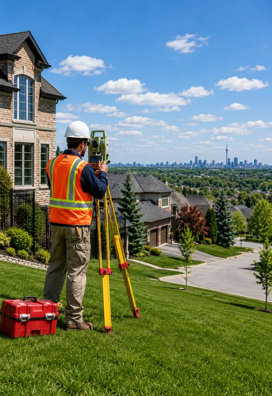
Licensed OLS Professionals on Our Team
Every topographic survey is conducted by licensed Ontario Land Surveyors on our team — ensuring your documents are accepted by all GTA municipalities and engineering firms.
Latest Survey & Mapping Technology
We use precision GPS receivers, high-accuracy total stations, and professional CAD software to deliver topographic surveys with exceptional detail and accuracy.
Fast 5–10 Day Turnaround
Project timelines are tight. We deliver your certified topographic survey within 5–10 business days so your architect or engineer can proceed without delays.
Transparent Pricing — No Hidden Fees
We provide clear upfront quotes before any work begins. What you are quoted is exactly what you pay — no surprise charges or add-ons after the survey is complete.
300+
Topographic Surveys Completed
20+
GTA Cities Served
99%
Client Satisfaction Rate
5–10
Day Turnaround
Ready to get your topographic survey started? Get a free quote from our licensed OLS team today.
Get Your Free QuoteService Areas
Our licensed OLS team delivers certified topographic surveys across the entire Greater Toronto Area — fast, accurate, and accepted by every municipality and engineering firm in the region.
Currently serving all GTA municipalities
FAQ
Have questions about topographic surveys in the GTA? We have answers. If you don't find what you're looking for our team is happy to help.
What is a topographic survey?
When do I need a topographic survey in Ontario?
How long does a topographic survey take in the GTA?
How much does a topographic survey cost in Ontario?
What is included in a topographic survey deliverable?
Do I need a topographic survey for a building permit?
What is the difference between a topographic survey and a property survey?
Who prepares the topographic survey report?
Do you serve all cities across the Greater Toronto Area?
Related Services
We offer a full range of professional land surveying services across the GTA. Explore other services that are commonly needed alongside a topographic survey.
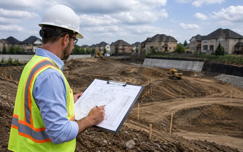
Grading & Site Plan Support
Your topographic survey data feeds directly into your grading plan. Our licensed OLS team provides the precise elevation data engineers need to design accurate drainage and grading solutions across the GTA.
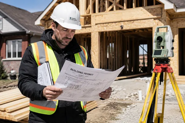
Survey for Building Permit
A topographic survey is often required alongside your building permit application. Our licensed OLS team provides both surveys together — saving you time and keeping your project on schedule across the GTA.
LiDAR & 3D Scanning
Need more advanced elevation data? Our LiDAR and 3D scanning services capture ultra-precise point cloud data for complex sites, large properties, and projects requiring the highest level of topographic detail across the GTA.
Get Started Today
Get a certified survey for your building permit application delivered by licensed OLS professionals on our team — accepted by all GTA municipalities, fast turnaround, no hidden fees.
5–10 Day Turnaround
Licensed OLS Team
All GTA Municipalities
No Hidden Fees